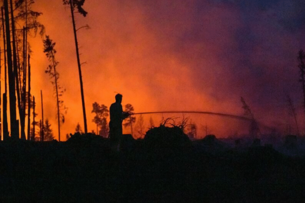
In times of rising temperatures, more irregular precipitation, and human carelessness, the probability of larger forest fires increases. This can be observed not only in the current, in part record-breaking fires in the Mediterranean region, but also in this country. A team around Florian Kraxner and Andrey Krasovskiy is searching, using a sophisticated system, including in Austria, for future wildfire hotspots. This is intended to help make forests fit for the future.
Experts at Geosphere Austria currently provide a forest fire danger forecast that reaches roughly three days into the future. The basis for this is longer-term precipitation data and shorter-term weather forecasts. This system is sufficiently accurate for the immediate preview, said Florian Kraxner, who works at the International Institute for Applied Systems Analysis (IIASA) in Laxenburg near Vienna, in a conversation with the APA.
With his team, he heads a project called “Austria Fire Futures,” running within the Austrian Climate Research Program (ACRP), and has been researching for several years with partners from the University of Natural Resources and Life Sciences, Vienna, and the Federal Research Centre for Forests (BFW) on a detailed recording of combustible material in forests of various world regions. The scientists refer to this as “fuel”—which can be translated into German as Brennstoff.
How fire-hazardous is a place in 100 years?
“In contrast to other approaches, we at IIASA look further into the future with our models. We try to identify global fire risk hotspots,” said Kraxner. For this, using the in-house developed model called “FLAM,” they calculate the probability of forest fires, their potential extent, intensity, and the emissions of pollutants from them under various climate scenarios, regional population development, and forms of forest management for the coming decades.
The experts want to resolve as precisely as possible “what grows and lies on the ground there” and how moist the soil and the fuel are. How close human activities take place is also an important factor. A special feature is also the specific calculation of the so-called “forest fire fighting efficiency”—that is, how quickly a fire can be detected and fought or extinguished.
Ultimately, the aim is to estimate how dangerous a place will be in ten or in 100 years. The goal is to issue recommendations for forest management, for example when it comes to reducing the available “fuel” in a particularly endangered area in the medium term. For this one needs more knowledge than merely whether it is a mixed forest shaped more by deciduous trees in lower elevations or a high forest formed more by conifers. “Ultimately, we want to issue recommendations on how we make our forest climate-fit,” emphasized Kraxner.
Expert: We need active forest restructuring
For example, there already exists a system of the Federal Research Centre for Forests (BFW) with various traffic-light colors for various tree species at different elevations in Austria. Kraxner and his team can then provide information on the question of future fire hazard—also aligned with the economic, touristic, or ecological functions the forest is to fulfill.
The further development of the forest does not happen by itself. If one allows a spruce that is actually no longer appropriate at a given site to die off naturally, the chance is high that another spruce will follow at the same site—which will then likewise be overtaxed by rising temperatures, the heat-induced increase in bark beetle infestation, and possible water scarcity. “This way we achieve no change,” said Kraxner: if one wants a forest fit for the future, one must “intervene actively, massively, and over a long period.”
“There will be more fires”
The necessary “transition,” or forest restructuring, is a major task for which short-term danger situations and long-term developments must be taken into account. With constant analyses, it is also possible to decide better where fire brigade units should be stationed in the future or already now “in order to reach the hotspots of the future as quickly as possible.”
What is clear is: “There will be more fires” that must be extinguished quickly—and indeed in Austria as well, for example in southern Lower Austria, in large parts of Carinthia, or in the border area between Salzburg and Upper Austria. Municipalities, forest owners, foresters, and forest managers must be involved here, for example to give tourists more information on fire prevention or to close particularly endangered hiking routes during dry periods. The mere knowledge that one lives or vacations in a hotspot region can achieve a great deal.
Researchers have a closer eye on Austria, South Korea, and Sardinia
Viewed globally, the “FLAM” model operates on a grid of around 50 by 50 kilometers; in Austria one already gets to a side length of one kilometer to 500 meters. In addition to global analyses, the scientists can also examine, among other things, the situation in South Korea, which has again been hit by severe fires this year, or in Sardinia, likewise heavily affected again this summer, at the highest resolution. The team works intensively with experts from these countries.
Calculated are the fire ignition risk and the expected burned area, on which the assessment of hazard following the traffic-light logic ultimately is based. A side detail: in sparsely populated regions in the north, lightning is the greatest fire trigger; in our latitudes it is almost always humans.
Changed rain patterns prepare the ground for larger fires
As far as global warming is concerned, “we are unfortunately on a very bad path,” emphasized Kraxner. If one looks with the model at the climate pathways with currently realistically high temperature increases, continuously somewhat higher expected forest area losses also result for all provinces. While, calculated backwards, in the period from 2001 to 2020 around 65 hectares burned nationwide per year, in the unfavorable climate scenarios toward the end of the century (2081–2100) it would be between around 85 and just under 100 hectares per year. The largest expected burned areas would then, according to an evaluation by the team, be expected in Lower Austria and Tyrol with up to almost 25 and 21 hectares annually, as well as in Carinthia (around 16.5 hectares).
Even now, the climatic changes are having a strong impact on the local forest systems. Historically, larger forest fires were hardly present in our latitudes. In recent years, however, the trend has also been toward more extensive fires in this country. This is due, among other things, to precipitation patterns that are changing in a “very conspicuous” way.
Lots of rain in the summer, as this year, is good for reducing the fire danger in the hotter season. But if the snow from the winter that melts slowly in the spring is lacking—as has been the case in many recent years—there is a lack of moisture in the spring and the following seasons. It is precisely then that nature particularly needs the moisture to keep the probability of fire low over the year, emphasized Kraxner.
